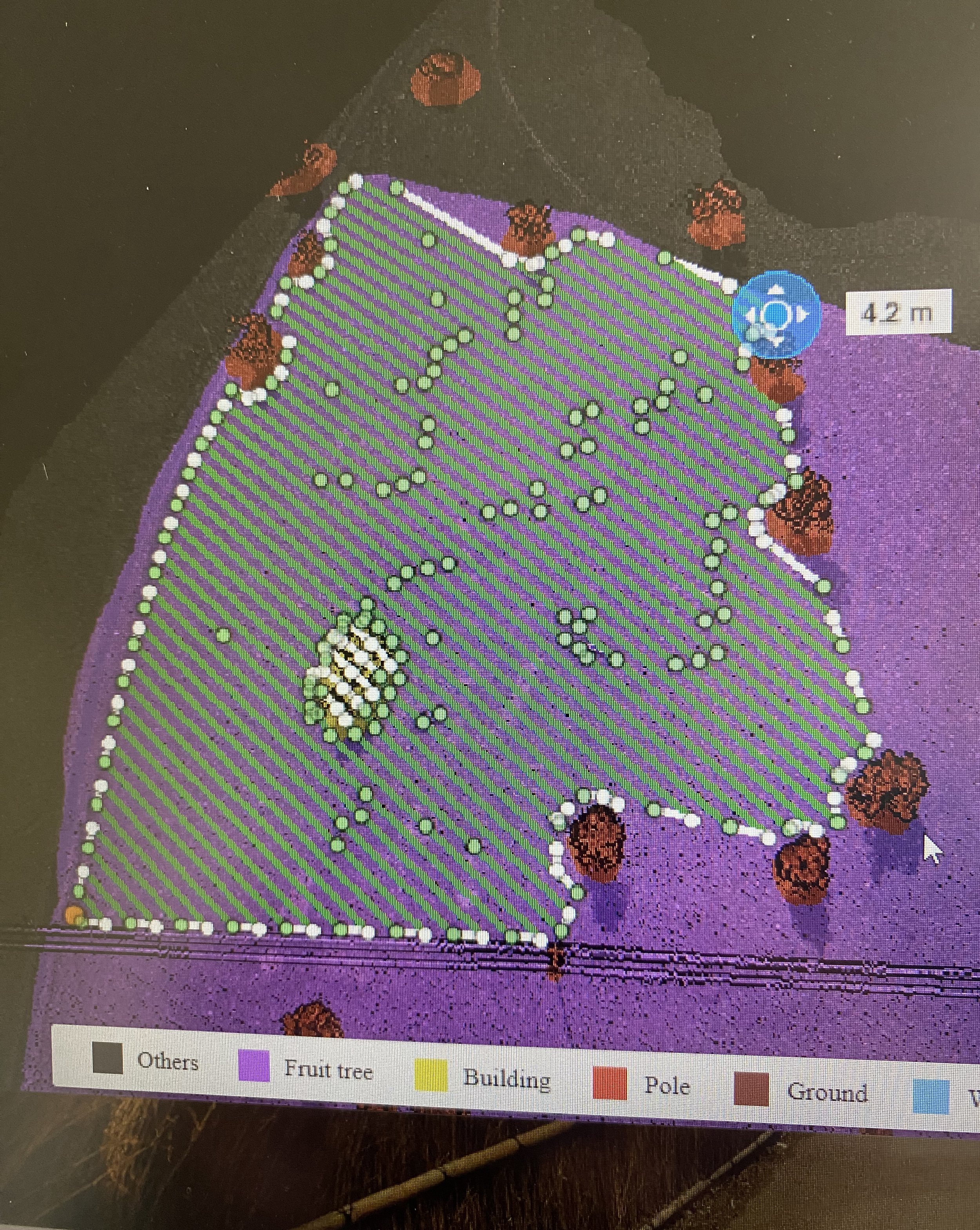
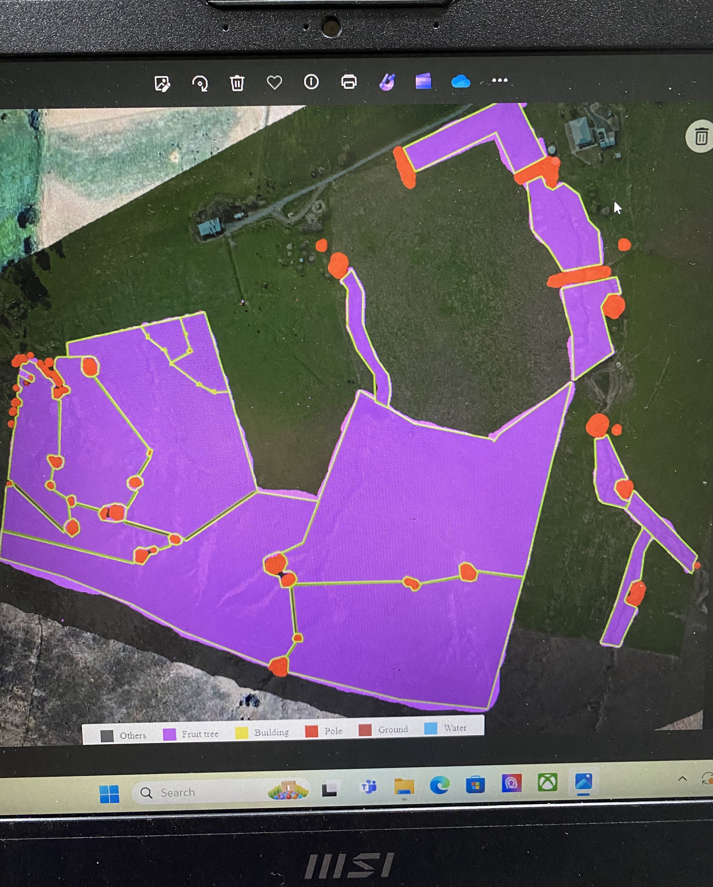
Precision Mapping
By utilising our DJI mapping drone and advanced processing technology, we can create detailed, high-resolution images of your land. These images enable the construction of precise 3D flight paths that allow us to target specific areas and avoid elements such as trees and waterways.
Mapping technology by drone proves to be perfect in situations of rough, hilly and obstacle filled terrain types, alongside patchy weed infestations like blackberries. DJI Terra is the processing technology which allows us to identify weeds from the stitched images to paint different areas where we want to spray, avoid, fly over without spraying and point where the flight path boundaries are located. Once given the information Terra automatically generates the most efficient flight route for our spray drone.
Our mapping drone minimises issues of overlap, ensuring accurate and targeted application of the required product.